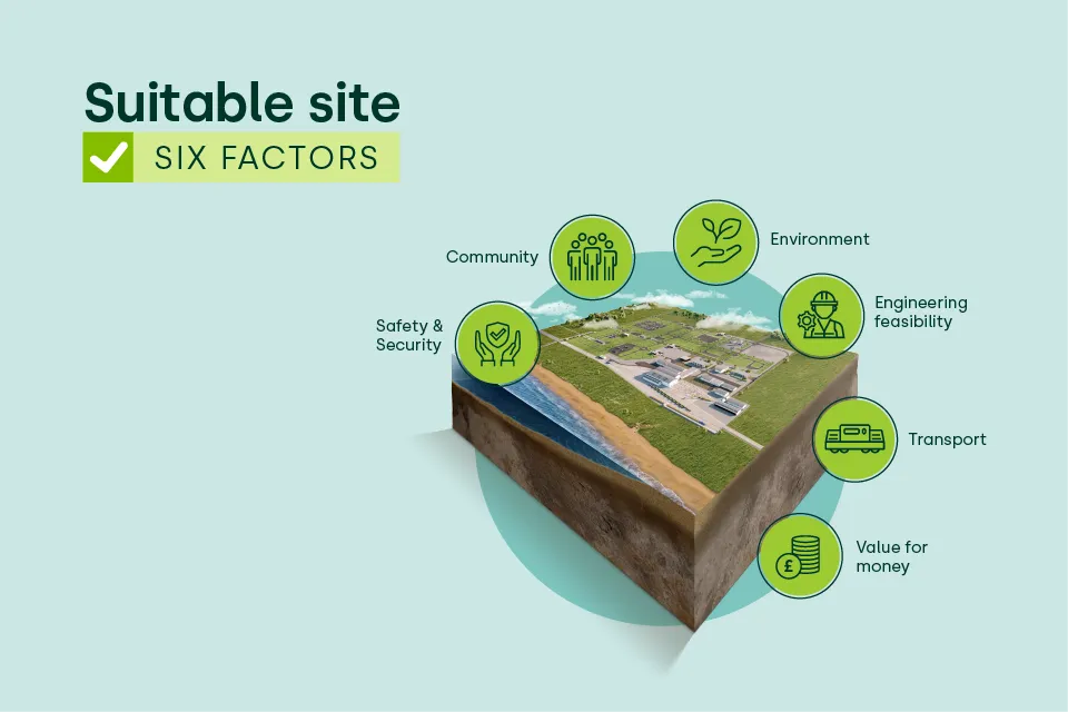
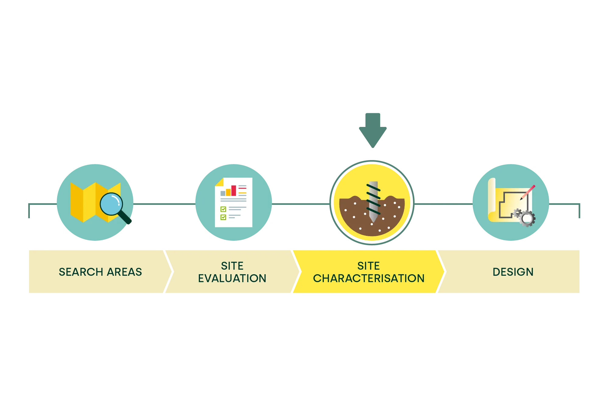
Site Characterisation
Site Characterisation plays a key role in the journey to a Geological Disposal Facility (GDF). It is the process by which NWS develops a detailed understanding of the geology and the associated environment relative to an Area of Focus, to determine whether it is a suitable site to safely host a GDF.
NWS must make two key siting decisions as part of the GDF programme that require Secretary of State for Energy Security and Net Zero approval. The first of these is a decision to identify a community or communities to progress to deep borehole investigations as part of the GDF siting process, and the second will be to enable final site selection for the GDF which comes later.
Taking this first decision on identifying a community or communities to progress to deep borehole investigations represents a significant step for the overall GDF siting process.
What is Site Characterisation?
Site Characterisation includes further investigative work, including drilling deep boreholes as part of a detailed site investigation, to understand more about the geology deep below the surface where a GDF could be built.
Surface-based assessments, like seismic surveys, also form an important part of the site investigation, allowing us to build a more detailed picture of the area’s geological characteristics. This evidence-led approach supports the wider GDF siting process by helping determine what to investigate next and whether an area could progress further.
The information gathered from Site Characterisation is essential to secure the necessary regulatory permissions to build a GDF and will be key in the development of a GDF design and safety case, ensuring the facility is safe and secure.
How long does Site Characterisation take?
The Site Characterisation stage is a long period of time, potentially taking around ten years. During this time, ongoing site investigation work may identify reasons why an area is not suitable, which may result in NWS withdrawing from that community.
After the Site Characterisation work is completed, NWS will move to the next major phase of selecting a site and seeking approvals for the GDF itself, in line with the GDF siting process. Before NWS can seek the regulatory approvals required for the GDF (including a new Development Consent Order and Environmental Permit, as well as a Nuclear Site Licence), there must first have been a positive Test of Public Support in the Potential Host Community relevant community.
What permissions are needed?
The drilling of deep boreholes for Site Characterisation is a key element of the site investigation and requires a Development Consent Order as well as Environmental Permits.
A Development Consent Order is the planning consent required to progress developments categorised as Nationally Significant Infrastructure Projects, defined in the Planning Act 2008.
Environmental permits establish conditions which projects must meet in order to protect people and the environment. Permits are granted and regulated by the Environment Agency in England.
Learn more about the GDF Siting Process